londoner
thinking on '73 stock
Posts: 480 
|
Post by londoner on Dec 10, 2018 16:24:38 GMT
Is there any reason why the Special fares apply is missing from Watford Jct and Shenfield? Is it definitely not there or just difficult to see in the lighting with the current photos we have? |
|
|
|
Post by goldenarrow on Dec 10, 2018 16:54:17 GMT
Is there any reason why the Special fares apply is missing from Watford Jct and Shenfield? Is it definitely not there or just difficult to see in the lighting with the current photos we have? The maps that beingcharley kindly got for us at the Christmas Social of which I was looking at one in person doesn't have them for sure. The online version of the map on IanVisits doesn't have them either. |
|
|
|
Post by goldenarrow on Dec 10, 2018 17:39:43 GMT
Online maps for both the Tube Map and the Tube & Rail services map are now up. The latter has gained the pecked lines too.
|
|
|
|
Post by Dstock7080 on Dec 10, 2018 18:00:40 GMT
Online maps for both the Tube Map and the Tube & Rail services map are now up. The latter has gained the pecked lines too. new December 2018 Night Tube too |
|
Chris M
Global Moderator
Forum Quizmaster
Always happy to receive quiz ideas and pictures by email or PM
Posts: 19,762
|
Post by Chris M on Dec 10, 2018 21:30:27 GMT
All the changes I think there are between the May and December tube maps in more detail than anybody probably wants:
Changes in the digital tube map May to December 2018:
Major changes: walk lines, change in shape of North London Line between Camden Road and west of Willesden Junction, change in shape of Met/Jubilee lines around Baker Street, lighter shade of grey used for even numbered zones, no "special fares apply" labels.
Other changes:
Zones and labels: new zone six label south of Uxbridge.
Zone one lable east of Bayswater moves southwest slightly, zone 3-5 lables in the west to north of the TfL Rail line to line up with it and a zone 2 label is added north of East Acton, also in line.
Zone 8 boundary moves closer to Watford Junction. Zone 8 label moves east slightly to become almost centred on gridline
Zone 1/2 boundary now has a significant southward extension to accomodate St John's Wood.
Zone 2, 3 and 4 lables in north centre of the map move west slightly. Zone 4 label moves south a bit and zone 2 north a bit at the same time.
From Wembley Park clockwise round to the east edge of the map zone 4 moves outwards slightly compressing Zone 5, except: northwest of Edgware where zone 6 is the one that is squeezed and southeast of the District line where Zone 4 shrinks.
Zone 2 label west of Surrey Quays moves further west
Station labels: Kentish Town West now north of line and on three lines.
Tottenham Hale now south of the line (to make way for Seven Sisters-South Tottenham walk line.
Bond Street now on two lines.
Warren Street label now east of station.
Great Portland Street moves south of line.
Baker Street moves to southwest of Bakerloo and Jubilee blob (was previously northest of the SSR blob) in consequence of St. John's Wood station moving.
Riverbus symbol at Embankment now at start of second line not end of first
Riverbus and NR symbols at Vauxhall now left (previously right) aligned
Preston Road is now on one line
Woolwich Arsenal label now right of blob (previously below)
Westferry and Canary Wharf gain Riverbus interchange symbols (Canary Wharf pier is roughly the same distance walk from both, but isn't signposted from the former)
Piccadilly line and TfL Rail stations at Heathrow T2&3 and T4 are now connected interchange stations. Piccadilly line at T4 is now southeast of the TfL Rail station blob not south. The airport symbol moves from north of the T5 branch to inside the T4 loop, west of the TfL Rail line.
Riverbus symbol at Imperial Wharf moves from below to right of station name
SSR: Royal Oak and Westbourne Park move slightly south.
Euston Square now west of Northern line.
Blackfriars to Cannon Street diagonal moves slightly east
Kensington Olympia branch slightly shorter
Jubilee line: Kingsbury to Stanmore all move west slightly
St. John's Wood moves south of London Overground and is now level with Marylebone and Euston.
The sections of Jubilee and Waterloo & City line that run northeast-southwest west of London Bridge move away from each other slightly.
Northern line: Edgware branch now slightly longer: Golders Green station remains in the same place, stations north have moved slightly northwest and Hampstead has moved slightly southeast. Belize Park has moved a long way south east in consequence of changes to North London line (now very close to Gospel Oak).
South Wimbledon to Tooting Bec move northeast slightly, Clapham South to Clapham North move southwest slightly. Balham doesn't move.
Piccadilly line: Caledonian Road-Finsbury Park stations have moved slightly southwest, Manor House remains in the same spot, stations Turnpike Lane-Cockfosters move slightly north.
LO Liverpool Street lines: Bruce Grove to Edmonton Green move slightly north. Stamford Hill moves slightly south. Chingford moves slightly north.
LO Watford DC: now offset slightly from Bakerloo line Queens' Park to Harrow. South Hampstead now east of Met/Jubilee
LO Goblin: Gospel Oak blobs now arragned vertically and link is much shorter.
LO North London Line: Now runs northeast-southwest (not east-west) through Willesden Junction
Hampstead Heath now west of Northern line. From the kink west of Hackney Central to Stratford the line moves very slightly north, but the station labels don't move, making them now off-centre. It is also now offset slightly from the District line Richmond branch. Gunnersbury moves south slightly.
LO East London line: Dalston Junction and Haggerston move slightly north. New Cross branch now mainly parallel to West Croydon branch. Rotherhithe and the junction south of Surrey Quays both move south slightly
LO South London line: both Peckham stations move west slightly, the kink east of Queen's Road Peckham moves north
LO West London: Imperial Wharf moves west slightly
DLR: West Silvertown-London City Airport move slightly southeast
Mudchute-Heron Quays all move north slightly
TfL Rail west: Link at Paddington now slightly longer.
Trams: Change in shade of green: Previously: hex 77CA3A, now: hex B7D688
Addiscombe to Harrington Road section now runs northeast not north. Birkbeck to Beckenham junction move east and Elmers End branch shortens in consequence
In consequence of South Wimbledon-Morden Road walkline Merton Park to Wandle Park all move west slightly.
Centrale to Wellesley Road move east slightly, possibly in consequence of change to walk line at West Croydon.
Access changes: Newbury Park now step-free to platform (previously not step free)
Upney and Fulham Broadway now step-free to train (previously to platform only)
Victoria SSL now step-free to platform (previously not step free)
Daggers:
+ Earl's Court, East Ham
- Brixton, Kennington, Victoria
misc: Grid lines and river edge lines become darker and much closer to Victoria line blue
Key to symbols gains explanation of walklines extending the whole key further right. The white background to it now implies that zones 3 and 5 merge southwest of Wimbledon.
|
|
Deleted
Deleted Member
Posts: 0
|
Post by Deleted on Dec 11, 2018 14:28:22 GMT
Does anyone know if there's a PDF version of Tube & Rail map as well?
I can't find it.
|
|
|
|
Post by goldenarrow on Dec 11, 2018 14:29:50 GMT
|
|
Deleted
Deleted Member
Posts: 0
|
Post by Deleted on Dec 11, 2018 14:37:54 GMT
Thank you!
|
|
|
|
Post by Dstock7080 on Dec 11, 2018 22:20:20 GMT
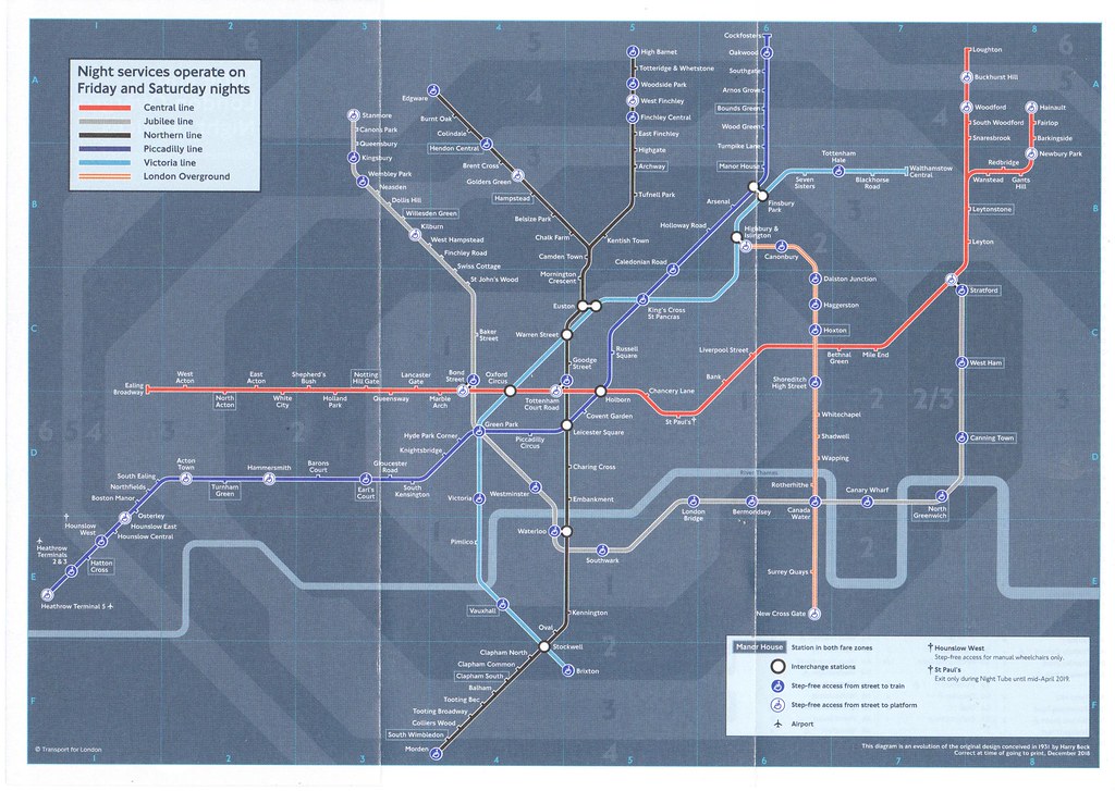
Night Tube version: (Whitechapel Overground open)   |
|
londoner
thinking on '73 stock
Posts: 480 
|
Post by londoner on Dec 15, 2018 19:41:44 GMT
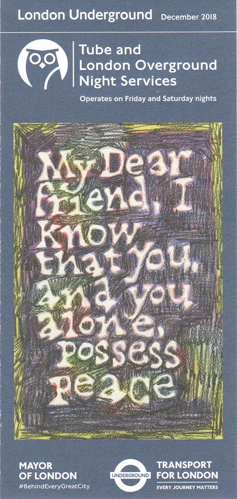
Does anyone know which stations, which don't have night tube, tend to stock the night tube map?
Which station is it easiest to pick up a copy of the night tube map?
|
|
|
|
Post by MoreToJack on Dec 15, 2018 20:46:24 GMT
Most z1 stations should have copies, as should all the Gateways.
A polite email to Art on the Underground can often also result in a delivery. :-)
|
|
londoner
thinking on '73 stock
Posts: 480 
|
Post by londoner on Dec 15, 2018 21:10:25 GMT
Most z1 stations should have copies, as should all the Gateways. A polite email to Art on the Underground can often also result in a delivery. :-) Cheers. The reason I ask is because I try to avoid zone 1 and live in a region of London where night tube does not operate. I do use Earl's Court quite a bit but haven't noticed the new maps (or any for that matter). I'll try to check again next week. I'd prefer not to email because its just otherwise laziness on my part! |
|
Chris M
Global Moderator
Forum Quizmaster
Always happy to receive quiz ideas and pictures by email or PM
Posts: 19,762
|
Post by Chris M on Dec 15, 2018 22:19:34 GMT
A polite email to Art on the Underground can often also result in a delivery. :-) I wish I'd know that a few years ago! Organising a major international conference we wanted to give every attendee (around 2000) a tube map, but station staff I asked weren't able to help with bulk and the press office wanted an extortionate amount (nearing £1/copy iirc, which was outside our budget). So for a couple of months I just grabbed a large handful every time I passed a rack with some in - Liverpool Street and Old Street in particular must have seen their stocks depleted far faster than normal! |
|
rincew1nd
Administrator
Junior Under-wizzard of quiz
Posts: 10,286 
|
Post by rincew1nd on Dec 16, 2018 3:34:12 GMT
It is a shame that a TfL fringe organisation has to fulfil what should be a core TfL function.
(This is not a derogatory comment aimed at Art On The Underground; they do a good job, just a shame that centrally funded bodies can't/won't do this even though it appears to be their prime purpose.
|
|
|
|
Post by John Tuthill on Dec 16, 2018 12:42:51 GMT
It is a shame that a TfL fringe organisation has to fulfil what should be a core TfL function. (This is not a derogatory comment aimed at Art On The Underground; they do a good job, just a shame that centrally funded bodies can't/won't do this even though it appears to be their prime purpose. I agree. When you look at the classic pre-war posters that were commissioned by the LTE, in MY opinion only, they are not even close these days.  |
|
Chris M
Global Moderator
Forum Quizmaster
Always happy to receive quiz ideas and pictures by email or PM
Posts: 19,762
|
Post by Chris M on Dec 16, 2018 13:01:41 GMT
|
|
londoner
thinking on '73 stock
Posts: 480 
|
Post by londoner on Dec 16, 2018 19:21:28 GMT
TfL also have maps specifically stuck onto ticket machines. These ticket machine maps are dated Dec 2018 but have zones which are clearly color coded in the style of the older maps.  |
|
|
|
Post by AndrewPSSP on Dec 16, 2018 22:26:35 GMT
These ticket machine maps are dated Dec 2018 but have zones which are clearly color coded in the style of the older maps. I've always wondered why that is. I quite like the coloured zones and they distinguish the zones a bit more clearly IMO. |
|
|
|
Post by Red Dragon on Dec 17, 2018 7:00:04 GMT
These ticket machine maps are dated Dec 2018 but have zones which are clearly color coded in the style of the older maps. I've always wondered why that is. I quite like the coloured zones and they distinguish the zones a bit more clearly IMO. Presumably because this is more important at ticket machines which are used for ticketing purposes than fir tube maps which are more navigational and need to be less cluttered (although whether that’s fulfilled at the moment is debatable!) |
|
|
|
Post by danwoodhouse on Jan 2, 2019 21:49:31 GMT
what happened about under 10 mins from Queensways to Bayswater
you can stand outside one of those stations and see the other without staining your eyes!
|
|
|
|
Post by goldenarrow on Jan 2, 2019 22:29:31 GMT
what happened about under 10 mins from Queensways to Bayswater you can stand outside one of those stations and see the other without staining your eyes! I have a feeling alot of this has to do with aesthetics as there simply isn't the space to fit in all the OSI's that fall within the 10 min threshold. Kilburn to Brondesbury isn't shown presumably due to the Metropolitan line scything through the area. |
|
londoner
thinking on '73 stock
Posts: 480 
|
Post by londoner on Jan 2, 2019 23:17:23 GMT
what happened about under 10 mins from Queensways to Bayswater you can stand outside one of those stations and see the other without staining your eyes! It was stated somewhere earlier in the thread that some OSI changes are not shown if they can be made easily enough without exiting a station. In this case, the connection is made at Notting Hill Gate. |
|
|
|
Post by goldenarrow on Jan 2, 2019 23:26:04 GMT
Interesting that the TfL Rail and Piccadilly Line stations at Heathrow get the solid connection even though there are two gate lines at two distinctly separate stations.
|
|
Deleted
Deleted Member
Posts: 0
|
Post by Deleted on Jan 3, 2019 15:26:35 GMT
And quite far away too!
|
|
|
|
Post by MoreToJack on Jan 3, 2019 17:23:03 GMT
Let's not expect consistency from an organisation that (will eventually) bring us the Elizabeth Line line (if we're consistent with the Metropolitan line etc.) and Battersea Power (as opposed to Battersea Power Station station, like, say, Hammersmith station).
|
|
|
|
Post by melikepie on Jan 3, 2019 20:20:35 GMT
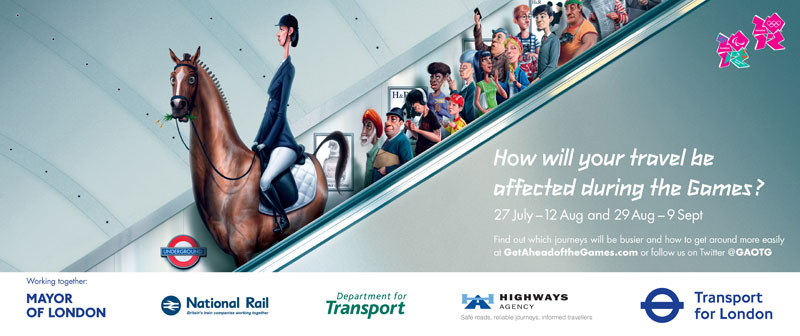
I disagree, some of the modern posters are of equal standing to the classic ones.  :sharpen(0.5,0.5,true)/https://www.ltmuseumshop.co.uk//static/media/catalog/product/2/2/228305.png) :sharpen(0.5,0.5,true)/https://www.ltmuseumshop.co.uk//static/media/catalog/product/2/2/224215.png) Reminds me of the crazy topic I brought up on animals on the Underground a little while ago. districtdavesforum.co.uk/thread/19899/horse |
|


